
Make a donation
Gear up for your next adventure:
As an Amazon Associate, this site earns from qualifying purchases at no extra cost to you.
Melezet topographic map
Click on the map to display elevation.
Make a donation
Gear up for your next adventure:
As an Amazon Associate, this site earns from qualifying purchases at no extra cost to you.
Melezet
Melezet ligt op 1312 meter hoogte en biedt plaats aan 7646 toeschouwers. De accommodatie is verdeeld in een tweetal secties, waarvan één geschikt is voor de reuzenslalom en de andere bestemd is voor de halfpipe. De baan voor de reuzenslalom is een groot gebied waar verschillende moeilijkheidsgraden gekozen kunnen worden. De piste is in zijn geheel van start tot finish voor de toeschouwers te zien. Dat is ook het geval bij de baan voor de halfpipe. Deze is zelfs nieuw aangelegd voor de Winterspelen. De halfpipe is 130 meter lang en beschikt over een machine om sneeuw te produceren.
Make a donation
Gear up for your next adventure:
As an Amazon Associate, this site earns from qualifying purchases at no extra cost to you.
About this map
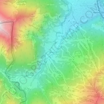
Name: Melezet topographic map, elevation, terrain.
Location: Melezet, Bardonecchia, Turijn, Piëmont, 10052, Italië (45.04044 6.66432 45.08044 6.70432)
Average elevation: 1,689 m
Minimum elevation: 1,249 m
Maximum elevation: 2,526 m
Make a donation
Gear up for your next adventure:
As an Amazon Associate, this site earns from qualifying purchases at no extra cost to you.