Geolocate

Orden topographic map

Click on the map to display elevation.

About this map

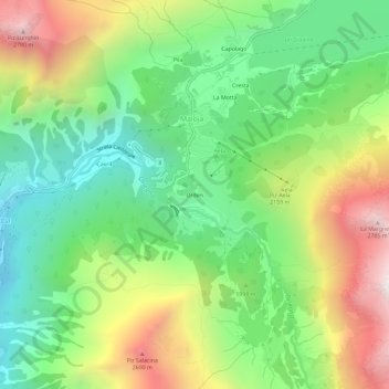
Name: Orden topographic map, elevation, terrain.

Location: Orden, Maloja, Bregaglia, Maloja, Grisons, 7516, Switzerland (46.37368 9.67586 46.41368 9.71586)

Average elevation: 1,988 m

Minimum elevation: 1,449 m

Maximum elevation: 2,844 m

Gear up for your next adventure:

🧰Multitool Knife - Compact and versatile tool for outdoor use
🥾Hiking Gaiters - Protect legs and shoes from mud, snow, and debris
🥾Lightweight Hiking Shoes - Comfortable shoes for day hikes
🛶Waterproof Dry Bags - Keep electronics and clothes dry during river crossings
🌡️Emergency Mylar Blankets - Compact thermal protection for unexpected nights outdoors

As an Amazon Associate, this site earns from qualifying purchases at no extra cost to you.