Geolocate

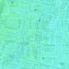
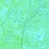
Mulyorejo topographic map

Click on the map to display elevation.

About this map

Name: Mulyorejo topographic map, elevation, terrain.

Location: Mulyorejo, Surabaya, East Java, Indonesia (-7.28943 112.76213 -7.24447 112.83699)

Average elevation: 2 m

Minimum elevation: -7 m

Maximum elevation: 8 m

Other topographic maps

Click on a map to view its topography, its elevation and its terrain.
Caribbean Island

Indonesia > East Java > Surabaya > Keputih

Average elevation: 0 m

Taman Harmoni

Indonesia > East Java > Surabaya

Average elevation: 2 m

Taman Flora

Indonesia > East Java > Surabaya > Baratajaya

Average elevation: 5 m

Taman Suroboyo

Indonesia > East Java > Surabaya

Average elevation: 1 m

Caribbean Island

Indonesia > East Java > Surabaya

Average elevation: 0 m

Canberra

Indonesia > East Java > Surabaya > Manukan Wetan

Average elevation: 4 m

Taman Pelangi

Indonesia > East Java > Surabaya > Gayungan

Average elevation: 6 m

Gear up for your next adventure:

🔨Vehicle Emergency Tool - Safety tool for remote road trips to trailheads
🧥Softshell Jacket - Windproof and breathable jacket for hiking
🪑Ultralight Camping Stool - Compact seating for rest stops during long hikes
🧼Biodegradable Camp Soap - Environmentally friendly cleaning for gear and body
🧳Compression Sacks - Maximize space in your backpack by shrinking gear

As an Amazon Associate, this site earns from qualifying purchases at no extra cost to you.