Geolocate

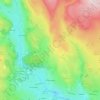
Osgodby topographic map

Click on the map to display elevation.

About this map

Name: Osgodby topographic map, elevation, terrain.

Location: Osgodby, North Yorkshire, England, YO11 3PT, United Kingdom (54.22425 -0.39801 54.26425 -0.35801)

Average elevation: 43 m

Minimum elevation: 0 m

Maximum elevation: 143 m

Other topographic maps

Click on a map to view its topography, its elevation and its terrain.
Scarborough

United Kingdom > England > North Yorkshire

The climate is temperate with mild summers and cool, windy, winters. The hottest months of the year are July and August, with temperatures reaching an average high of 17 °C and falling to 11 °C at night. The average daytime temperatures in January are 4 °C, falling to 1 °C at night. The station's elevation…

Average elevation: 50 m

East Harlsey

United Kingdom > England > North Yorkshire

Average elevation: 81 m

Grassington

United Kingdom > England > North Yorkshire

Average elevation: 310 m

Eggborough

United Kingdom > England > North Yorkshire

Average elevation: 12 m

Skipton

United Kingdom > England > North Yorkshire

Average elevation: 173 m

Goathland

United Kingdom > England > North Yorkshire

Average elevation: 204 m

Gear up for your next adventure:

🔥Camping Stove - Portable stoves to cook outdoors with ease
🧤Rechargeable Heated Gloves - Extreme warmth for Canadian winter expeditions
🧤Insulated Winter Gloves - Heavy-duty protection for sub-zero Canadian adventures
🥾Waterproof Trail Shoes - Shoes designed to handle wet terrain
🔦LED Flashlight - Powerful and long-lasting flashlight for camping and emergencies

As an Amazon Associate, this site earns from qualifying purchases at no extra cost to you.