Geolocate

Warwathane topographic map

Click on the map to display elevation.

About this map

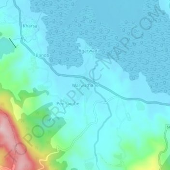
Name: Warwathane topographic map, elevation, terrain.

Location: Warwathane, Mhasla, Raigad, Maharashtra, India (18.12298 73.05824 18.16298 73.09824)

Average elevation: 43 m

Minimum elevation: -5 m

Maximum elevation: 290 m

Gear up for your next adventure:

🧼Biodegradable Camp Soap - Environmentally friendly cleaning for gear and body
🥾Mountaineering Boots - Supportive boots for climbing and high-altitude hiking
🧥Waterproof Jacket - Lightweight rain jackets for hiking and outdoor activities
🛁Quick-Dry Microfiber Towel - Space-saving towel that dries rapidly on the move
🚲Heavy Duty Bike Lock - Secure your bike at the trailhead or during stops

As an Amazon Associate, this site earns from qualifying purchases at no extra cost to you.