Geolocate

Crystal Lakes topographic map

Click on the map to display elevation.

About this map

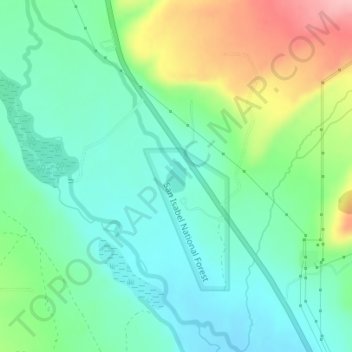
Name: Crystal Lakes topographic map, elevation, terrain.

Location: Crystal Lakes, Lake County, Colorado, United States (39.19378 -106.33962 39.19629 -106.33758)

Average elevation: 2,899 m

Minimum elevation: 2,855 m

Maximum elevation: 2,999 m

Other topographic maps

Click on a map to view its topography, its elevation and its terrain.

Lake Creek

United States > Colorado > Lake County

Average elevation: 3,293 m

Mount Evans

United States > Colorado > Lake County

Average elevation: 3,828 m

Gear up for your next adventure:

🎒Hiking Daypack - Lightweight and durable backpacks for day trips and excursions
💡LED Camping Lantern - Illuminate your campsite with long-lasting lanterns
🧥Thermal Fleece Jacket - Versatile insulation for changing mountain temperatures
🧊Insulated Water Bottle - Keeps drinks cold in summer and prevents freezing in winter
🧦Crew Hiking Socks - Comfortable socks for long-distance hikes

As an Amazon Associate, this site earns from qualifying purchases at no extra cost to you.