
Thank you for supporting this site ❤️
Make a donation
Make a donation
Gear up for your next adventure:
As an Amazon Associate, this site earns from qualifying purchases at no extra cost to you.
Bandenkop topographic map
Click on the map to display elevation.
Thank you for supporting this site ❤️
Make a donation
Make a donation
Gear up for your next adventure:
As an Amazon Associate, this site earns from qualifying purchases at no extra cost to you.
About this map
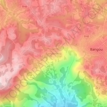
Name: Bandenkop topographic map, elevation, terrain.
Location: Bandenkop, Bangou, Hauts-Plateaux, West, Cameroon (5.22813 10.36066 5.26813 10.40066)
Average elevation: 1,765 m
Minimum elevation: 1,492 m
Maximum elevation: 1,915 m
Thank you for supporting this site ❤️
Make a donation
Make a donation
Gear up for your next adventure:
As an Amazon Associate, this site earns from qualifying purchases at no extra cost to you.