
Thank you for supporting this site ❤️
Make a donation
Make a donation
Gear up for your next adventure:
As an Amazon Associate, this site earns from qualifying purchases at no extra cost to you.
Semmerzake topographic map
Click on the map to display elevation.
Thank you for supporting this site ❤️
Make a donation
Make a donation
Gear up for your next adventure:
As an Amazon Associate, this site earns from qualifying purchases at no extra cost to you.
About this map
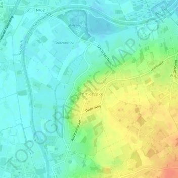
Name: Semmerzake topographic map, elevation, terrain.
Location: Semmerzake, Gavere, Gand, Flandre orientale, Flandre, Belgique (50.93140 3.64772 50.95628 3.68297)
Average elevation: 16 m
Minimum elevation: 2 m
Maximum elevation: 44 m
Thank you for supporting this site ❤️
Make a donation
Make a donation
Gear up for your next adventure:
As an Amazon Associate, this site earns from qualifying purchases at no extra cost to you.