Geolocate

Pany topographic map

Click on the map to display elevation.

About this map

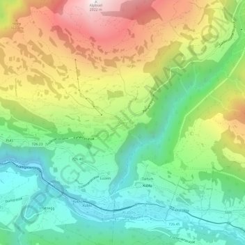
Name: Pany topographic map, elevation, terrain.

Location: Pany, Luzein, Prättigau/Davos, Grisons, 7243, Switzerland (46.90841 9.75144 46.94841 9.79144)

Average elevation: 1,236 m

Minimum elevation: 758 m

Maximum elevation: 2,012 m

Gear up for your next adventure:

📷Outdoor Action Camera - Capture high-elevation views and rugged adventures
🥾Waterproof Hiking Boots - Boots keeping your feet dry in wet conditions
🥤Collapsible Travel Cup - Saves space and weight in your mess kit
🛌Down Sleeping Bag - Superior warmth-to-weight ratio for cold nights
🛏️Sleeping Bag - Warm and compact sleeping bags for outdoor camping

As an Amazon Associate, this site earns from qualifying purchases at no extra cost to you.