Geolocate

Harju topographic map

Click on the map to display elevation.

About this map

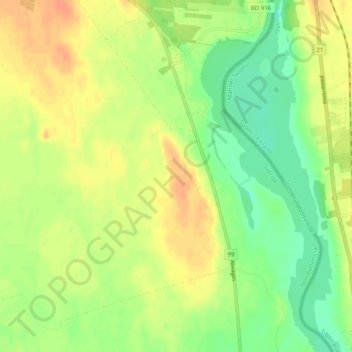
Name: Harju topographic map, elevation, terrain.

Location: Harju, Haparanda kommun, Norrbotten County, 95393, Sweden (66.10814 23.88081 66.14814 23.92081)

Average elevation: 34 m

Minimum elevation: 16 m

Maximum elevation: 50 m

Gear up for your next adventure:

Camping Groundsheet - Protect your tent from moisture and dirt
🧭GPS Tracker - Track your location in remote areas safely
🛁Quick-Dry Microfiber Towel - Space-saving towel that dries rapidly on the move
🥤Collapsible Travel Cup - Saves space and weight in your mess kit
🎒Hiking Daypack - Lightweight and durable backpacks for day trips and excursions

As an Amazon Associate, this site earns from qualifying purchases at no extra cost to you.