Geolocate

Kanth topographic map

Click on the map to display elevation.

About this map

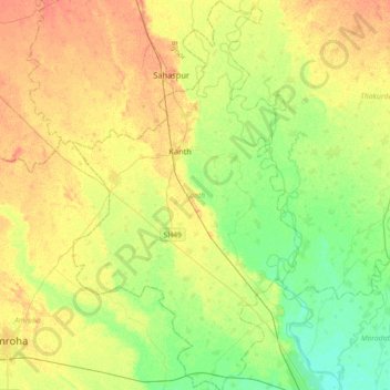
Name: Kanth topographic map, elevation, terrain.

Location: Kanth, Moradabad, Uttar Pradesh, India (28.86672 78.52918 29.18103 78.73868)

Average elevation: 211 m

Minimum elevation: 192 m

Maximum elevation: 230 m

Gear up for your next adventure:

Family Camping Tent - Spacious tent suitable for family camping trips
🥾Waterproof Hiking Boots - Essential footwear for rugged terrain and wet Canadian trails
🔦LED Headlamp - Hands-free lighting for early morning starts or late finishes
🧼Biodegradable Camp Soap - Environmentally friendly cleaning for gear and body
💧Filtered Water Bottle - Safe drinking water on the go

As an Amazon Associate, this site earns from qualifying purchases at no extra cost to you.