Geolocate

Mount Catherine topographic map

Click on the map to display elevation.

About this map

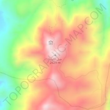
Name: Mount Catherine topographic map, elevation, terrain.

Location: Mount Catherine, St Catherine, South Sinai, Egypt (28.50938 33.95531 28.50948 33.95541)

Average elevation: 2,315 m

Minimum elevation: 1,937 m

Maximum elevation: 2,629 m

Gear up for your next adventure:

🥫Freeze-Dried Meals - Lightweight, high-calorie nutrition for multi-day treks
🥾Trekking Poles - Adjustable trekking poles to reduce knee stress and improve stability
Bushcraft Tarp - Versatile emergency shelter or gear protection
🛶Canoe Life Vest - Safety vest for water sports
🔦LED Headlamp - Hands-free lighting for early morning starts or late finishes

As an Amazon Associate, this site earns from qualifying purchases at no extra cost to you.