Geolocate

N. Hlimen topographic map

Click on the map to display elevation.

About this map

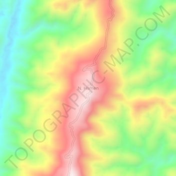
Name: N. Hlimen topographic map, elevation, terrain.

Location: N. Hlimen, 'N' Thingdawl, Kolasib, Mizoram, India (24.21519 92.78731 24.25519 92.82731)

Average elevation: 386 m

Minimum elevation: 91 m

Maximum elevation: 717 m

Gear up for your next adventure:

🧭GPS Tracker - Track your location in remote areas safely
🧢Outdoor Cap - Protective cap for sun and rain during hikes
🌡️Emergency Mylar Blankets - Compact thermal protection for unexpected nights outdoors
🛶Kayak Dry Bag - Waterproof storage for kayaking adventures
🔭Compact Binoculars - Lightweight optics for scouting trails and wildlife

As an Amazon Associate, this site earns from qualifying purchases at no extra cost to you.