Geolocate

Poblacion 13 topographic map

Click on the map to display elevation.

About this map
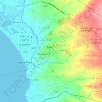
Name: Poblacion 13 topographic map, elevation, terrain.

Location: Poblacion 13, Taal, Batangas, Calabarzon, 4208, Philippines (13.85866 120.90382 13.89866 120.94382)

Average elevation: 38 m

Minimum elevation: 0 m

Maximum elevation: 115 m

Gear up for your next adventure:

💧Reusable Water Bottle - Durable water bottles for hydration on trails
🧴Outdoor Sunscreen - High SPF protection for high-altitude UV exposure
🪑Ultralight Camping Stool - Compact seating for rest stops during long hikes
💧Filtered Water Bottle - Safe drinking water on the go
🔥Emergency Fire Starter - Reliable ignition source for all weather conditions

As an Amazon Associate, this site earns from qualifying purchases at no extra cost to you.