Geolocate

Coyahuasi topographic map

Click on the map to display elevation.

About this map

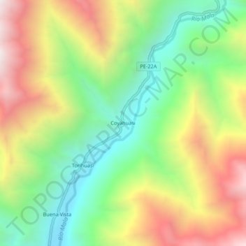
Name: Coyahuasi topographic map, elevation, terrain.

Location: Coyahuasi, Calango, Cañete, Lima, Perú (-12.44255 -76.43558 -12.40255 -76.39558)

Average elevation: 1,304 m

Minimum elevation: 708 m

Maximum elevation: 2,090 m

Gear up for your next adventure:

🥾Trail Hiking Shoes - Durable shoes designed for rugged trails
🔥Emergency Fire Starter - Reliable ignition source for all weather conditions
🧢Outdoor Cap - Protective cap for sun and rain during hikes
🔦LED Headtorch - Bright and durable light for night activities
Lightweight Camping Tent - Portable shelter optimized for Canadian backcountry camping

As an Amazon Associate, this site earns from qualifying purchases at no extra cost to you.