
Tircahan ED topographic map
Interactive map
Click on the map to display elevation.
About this map
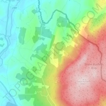
Name: Tircahan ED topographic map, elevation, terrain.
Average elevation: 190 m
Minimum elevation: 54 m
Maximum elevation: 402 m
Other topographic maps
Click on a map to view its topography, its elevation and its terrain.
Cock Island
Cock Island, Munterconnaught ED, Ballyjamesduff Municipal District, County Cavan, Irlande
Average elevation: 90 m