Geolocate

Rogers topographic map

Click on the map to display elevation.

About this map

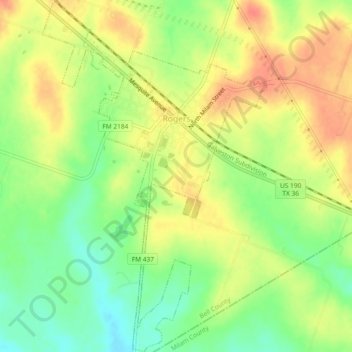
Name: Rogers topographic map, elevation, terrain.

Location: Rogers, Bell County, Texas, United States (30.90519 -97.24427 30.94480 -97.21484)

Average elevation: 159 m

Minimum elevation: 132 m

Maximum elevation: 182 m

Gear up for your next adventure:

💧Collapsible Water Bottle - Space-saving water bottle for outdoor activities
🌬️Windproof Camp Stove - Efficient cooking even on exposed mountain peaks
🏕️Camping Hammock - Integrated protection for sleeping between trees
🛌Down Sleeping Bag - Superior warmth-to-weight ratio for cold nights
🏃Hydration Running Vest - Carry water and maps close to your body for speed

As an Amazon Associate, this site earns from qualifying purchases at no extra cost to you.