Geolocate

Richmond topographic map

Click on the map to display elevation.

About this map

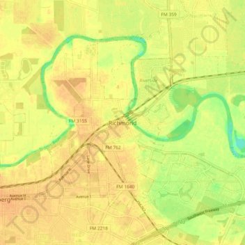
Name: Richmond topographic map, elevation, terrain.

Location: Richmond, Fort Bend County, Texas, 44769, United States (29.54218 -95.80078 29.62218 -95.72078)

Average elevation: 27 m

Minimum elevation: 7 m

Maximum elevation: 34 m

Gear up for your next adventure:

📷Outdoor Action Camera - Capture high-elevation views and rugged adventures
🛶Canoe Life Vest - Safety vest for water sports
🌡️Emergency Mylar Blankets - Compact thermal protection for unexpected nights outdoors
🛌Down Sleeping Bag - Superior warmth-to-weight ratio for cold nights
🔋Solar Power Bank - Keep your GPS and devices charged during long outdoor trips

As an Amazon Associate, this site earns from qualifying purchases at no extra cost to you.