Geolocate

Hallum topographic map

Click on the map to display elevation.

About this map

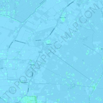
Name: Hallum topographic map, elevation, terrain.

Location: Hallum, Noardeast-Fryslân, Frisia, Netherlands (53.27543 5.72141 53.32453 5.84124)

Average elevation: -1 m

Minimum elevation: -4 m

Maximum elevation: 3 m

Other topographic maps

Click on a map to view its topography, its elevation and its terrain.

Oost-Vlieland

Netherlands > Frisia

Average elevation: 2 m

Kooiplaats

Netherlands > Frisia > Buren

Average elevation: 1 m

Loënga

Netherlands > Frisia > Loënga

Average elevation: 0 m

Vierhuizen

Netherlands > Frisia > Allingawier

Average elevation: -2 m

Leeuwarden

Netherlands > Frisia > Leeuwarden

Average elevation: 0 m

Gear up for your next adventure:

🔥Camping Stove - Portable stoves to cook outdoors with ease
🧴Outdoor Sunscreen - High SPF protection for high-altitude UV exposure
Backpacking Tent - Lightweight tent for long-distance hiking trips
🐕Hiking Dog Pack - Let your canine companion carry their own water and food
🔭Compact Monocular - One-handed bird watching and trail spotting

As an Amazon Associate, this site earns from qualifying purchases at no extra cost to you.