Geolocate

Kupa topographic map

Click on the map to display elevation.

About this map

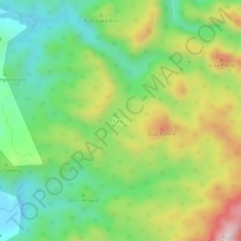
Name: Kupa topographic map, elevation, terrain.

Location: Kupa, Barru, South Sulawesi, Sulawesi, Indonesia (-4.13549 119.62639 -4.09549 119.66639)

Average elevation: 238 m

Minimum elevation: 5 m

Maximum elevation: 615 m

Gear up for your next adventure:

💡Solar Camping Lamp - Eco-friendly lighting for campsites
🧭GPS Tracker - Track your location in remote areas safely
Backpacking Tent - Lightweight tent for long-distance hiking trips
Camping Essentials - All-in-one gear for a comfortable camping trip
🔦LED Flashlight - Powerful and long-lasting flashlight for camping and emergencies

As an Amazon Associate, this site earns from qualifying purchases at no extra cost to you.