Geolocate

Ataköy topographic map

Click on the map to display elevation.

About this map

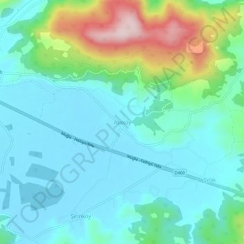
Name: Ataköy topographic map, elevation, terrain.

Location: Ataköy, Ula, Muğla, Aegean Region, Turkey (37.02233 28.37449 37.06233 28.41449)

Average elevation: 82 m

Minimum elevation: 2 m

Maximum elevation: 356 m

Gear up for your next adventure:

🔦UV Flashlight - Detect minerals or specific insects in the dark
🧣Merino Neck Gaiter - Protects against wind, sun, and cold at high altitudes
🔪Outdoor Multitool - Versatile tool for repairs and food prep in the wild
🧢Hiking Hat - Sun-protective and breathable hats for long treks
🧥Waterproof Jacket - Lightweight rain jackets for hiking and outdoor activities

As an Amazon Associate, this site earns from qualifying purchases at no extra cost to you.