
Thank you for supporting this site ❤️
Make a donation
Make a donation
Gear up for your next adventure:
As an Amazon Associate, this site earns from qualifying purchases at no extra cost to you.
Eşmepınar topographic map
Click on the map to display elevation.
Thank you for supporting this site ❤️
Make a donation
Make a donation
Gear up for your next adventure:
As an Amazon Associate, this site earns from qualifying purchases at no extra cost to you.
About this map
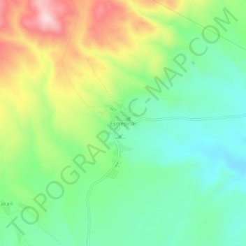
Name: Eşmepınar topographic map, elevation, terrain.
Location: Eşmepınar, Başkale, Van, Eastern Anatolia Region, Turkey (38.28545 44.25704 38.32545 44.29704)
Average elevation: 2,369 m
Minimum elevation: 2,249 m
Maximum elevation: 2,580 m
Thank you for supporting this site ❤️
Make a donation
Make a donation
Gear up for your next adventure:
As an Amazon Associate, this site earns from qualifying purchases at no extra cost to you.