
Pee Dee topographic map
Interactive map
Click on the map to display elevation.
About this map
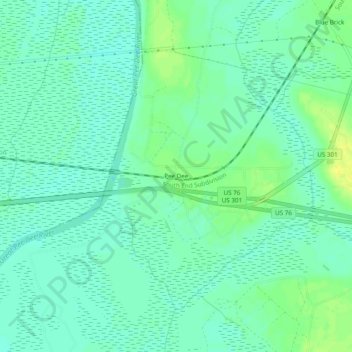
Name: Pee Dee topographic map, elevation, terrain.
Location: Pee Dee, Marion County, South Carolina, United States (34.18599 -79.55894 34.22599 -79.51894)
Average elevation: 16 m
Minimum elevation: 9 m
Maximum elevation: 27 m
Other topographic maps
Click on a map to view its topography, its elevation and its terrain.
Sellers
United States > South Carolina > Marion County
Sellers, Marion County, South Carolina, United States
Average elevation: 25 m
Mullins
United States > South Carolina > Marion County
Mullins, Marion County, South Carolina, 29574, United States
Average elevation: 30 m