
Thank you for supporting this site ❤️
Make a donation
Make a donation
Gear up for your next adventure:
As an Amazon Associate, this site earns from qualifying purchases at no extra cost to you.
Cañas topographic map
Click on the map to display elevation.
Thank you for supporting this site ❤️
Make a donation
Make a donation
Gear up for your next adventure:
As an Amazon Associate, this site earns from qualifying purchases at no extra cost to you.
About this map
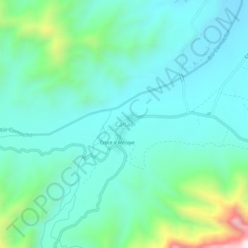
Name: Cañas topographic map, elevation, terrain.
Location: Cañas, Municipio Padcaya, Provincia Arce, Tarija, Bolivia (-21.91843 -64.87018 -21.87843 -64.83018)
Average elevation: 2,136 m
Minimum elevation: 1,985 m
Maximum elevation: 2,725 m
Thank you for supporting this site ❤️
Make a donation
Make a donation
Gear up for your next adventure:
As an Amazon Associate, this site earns from qualifying purchases at no extra cost to you.