Geolocate

Korba topographic map

Click on the map to display elevation.

About this map
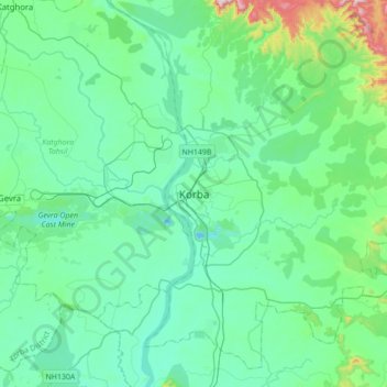
Name: Korba topographic map, elevation, terrain.

Location: Korba, Korba Tahsil, Korba, Chhattisgarh, 495600, India (22.19475 82.55109 22.51475 82.87109)

Average elevation: 322 m

Minimum elevation: 225 m

Maximum elevation: 830 m

Gear up for your next adventure:

👟Trail Running Shoes - Agile footwear for fast-paced topographic exploration
🧦Merino Wool Socks - Moisture-wicking comfort for long-distance hiking
💡LED Camping Lantern - Illuminate your campsite with long-lasting lanterns
📷Outdoor Action Camera - Capture high-elevation views and rugged adventures
🧤Rechargeable Heated Gloves - Extreme warmth for Canadian winter expeditions

As an Amazon Associate, this site earns from qualifying purchases at no extra cost to you.