
Thank you for supporting this site ❤️
Make a donation
Make a donation
Gear up for your next adventure:
As an Amazon Associate, this site earns from qualifying purchases at no extra cost to you.
Maggiano topographic map
Click on the map to display elevation.
Thank you for supporting this site ❤️
Make a donation
Make a donation
Gear up for your next adventure:
As an Amazon Associate, this site earns from qualifying purchases at no extra cost to you.
About this map
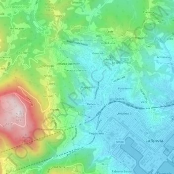
Name: Maggiano topographic map, elevation, terrain.
Location: Maggiano, Foce, La Spezia, Liguria, 19123, Italia (44.09568 9.78015 44.13568 9.82015)
Average elevation: 181 m
Minimum elevation: -3 m
Maximum elevation: 659 m
Thank you for supporting this site ❤️
Make a donation
Make a donation
Gear up for your next adventure:
As an Amazon Associate, this site earns from qualifying purchases at no extra cost to you.