Geolocate

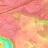
Millemont topographic map

Click on the map to display elevation.

About this map

Name: Millemont topographic map, elevation, terrain.

Location: Millemont, Rambouillet, Yvelines, Ile-de-France, Metropolitan France, 78940, France (48.79810 1.70264 48.82073 1.74885)

Average elevation: 141 m

Minimum elevation: 93 m

Maximum elevation: 191 m

Other topographic maps

Click on a map to view its topography, its elevation and its terrain.

Rodon

France > Ile-de-France > Yvelines

Average elevation: 167 m

Hautvilliers

France > Ile-de-France > Yvelines > Chevreuse

Average elevation: 127 m

La Corse

France > Ile-de-France > Yvelines > Élancourt

Average elevation: 165 m

Gear up for your next adventure:

🛌Down Sleeping Bag - Superior warmth-to-weight ratio for cold nights
🥾Hiking Leggings - Comfortable leggings for outdoor activities
🥾Trekking Poles - Adjustable trekking poles to reduce knee stress and improve stability
🧴Waterproofing Spray - Restore the DWR coating on jackets and tents
🦶Hiking Shoe Insoles - Added support for high arches and long days on feet

As an Amazon Associate, this site earns from qualifying purchases at no extra cost to you.