
Kothavalasa topographic map
Click on the map to display elevation.
About this map
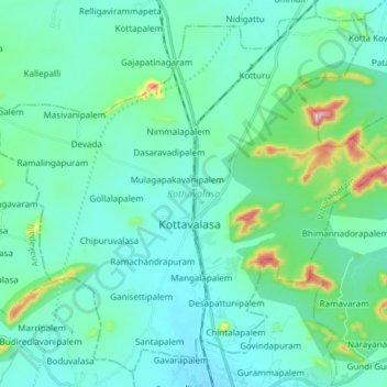
Name: Kothavalasa topographic map, elevation, terrain.
Location: Kothavalasa, Vizianagaram, Andhra Pradesh, India (17.84124 83.10865 17.97335 83.25997)
Average elevation: 89 m
Minimum elevation: 29 m
Maximum elevation: 416 m
Other topographic maps
Click on a map to view its topography, its elevation and its terrain.