Geolocate

Shokuvi topographic map

Click on the map to display elevation.

About this map

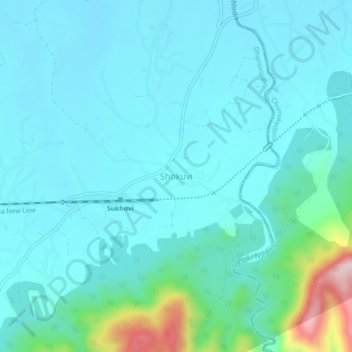
Name: Shokuvi topographic map, elevation, terrain.

Location: Shokuvi, Dhansiripar, Chümoukedima, Nagaland, India (25.74286 93.69958 25.78286 93.73958)

Average elevation: 217 m

Minimum elevation: 167 m

Maximum elevation: 509 m

Gear up for your next adventure:

🧤Thermal Hiking Gloves - Grip-enhanced gloves for cold-weather altitude trekking
💧Hydration Bladder - Hands-free hydration solution for long treks
🧥Thermal Layer - Insulating layer for cold outdoor conditions
🌬️Windproof Camp Stove - Efficient cooking even on exposed mountain peaks
🔦LED Headtorch - Bright and durable light for night activities

As an Amazon Associate, this site earns from qualifying purchases at no extra cost to you.