Geolocate

Tornetti topographic map

Click on the map to display elevation.

About this map

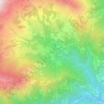
Name: Tornetti topographic map, elevation, terrain.

Location: Tornetti, Viù, Unione Montana Alpi Graie, Turin, Piedmont, Italy (45.23048 7.32159 45.27048 7.36159)

Average elevation: 1,333 m

Minimum elevation: 705 m

Maximum elevation: 2,100 m

Gear up for your next adventure:

🥾Mountain Hiking Shoes - Shoes with superior grip for mountainous terrain
🔋Emergency Crank Radio - Weather alerts and power without needing batteries
🧭GPS Handheld Device - Reliable GPS navigation for outdoor adventures
🦯Trekking Poles - Reduced impact on joints for steep topographic climbs
🥾Approach Boots - Comfortable boots for hiking and climbing approaches

As an Amazon Associate, this site earns from qualifying purchases at no extra cost to you.