Geolocate

Nochten topographic map

Click on the map to display elevation.

About this map

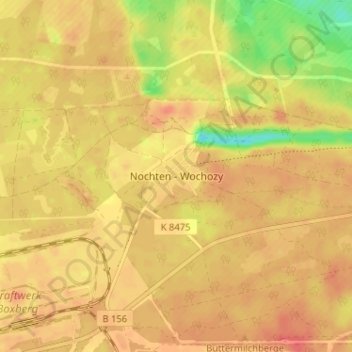
Name: Nochten topographic map, elevation, terrain.

Location: Nochten, Boxberg/O.L., Görlitz, Sachsen, 02943, Deutschland (51.41122 14.58076 51.45122 14.62076)

Average elevation: 128 m

Minimum elevation: 93 m

Maximum elevation: 143 m

Other topographic maps

Click on a map to view its topography, its elevation and its terrain.

Bärwalder See

Deutschland > Sachsen > Görlitz > Boxberg/O.L.

Average elevation: 124 m

Gear up for your next adventure:

🔋Solar Power Bank - Keep your GPS and devices charged during long outdoor trips
🥾Mountain Trail Shoes - High-traction shoes for mountain trails
🪜Heavy Duty Carabiners - Multi-use clips for securing gear to your backpack
🥾Trekking Poles - Adjustable trekking poles to reduce knee stress and improve stability
🥾Waterproof Hiking Boots - Essential footwear for rugged terrain and wet Canadian trails

As an Amazon Associate, this site earns from qualifying purchases at no extra cost to you.