Geolocate

Lake Ketchum topographic map

Click on the map to display elevation.

About this map

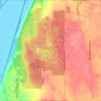
Name: Lake Ketchum topographic map, elevation, terrain.

Location: Lake Ketchum, Snohomish County, Washington, United States (48.26844 -122.36321 48.29756 -122.33536)

Average elevation: 56 m

Minimum elevation: -2 m

Maximum elevation: 88 m

Gear up for your next adventure:

🏕️Camping Hammock - Integrated protection for sleeping between trees
Family Camping Tent - Spacious tent suitable for family camping trips
🧣Evaporative Cooling Towel - Beat the heat during intense summer climbs
🧤Insulated Winter Gloves - Heavy-duty protection for sub-zero Canadian adventures
🥾Waterproof Hiking Boots - Boots keeping your feet dry in wet conditions

As an Amazon Associate, this site earns from qualifying purchases at no extra cost to you.