Geolocate

Castricum topographic map

Click on the map to display elevation.

About this map

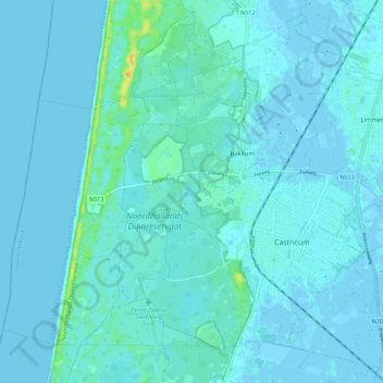
Name: Castricum topographic map, elevation, terrain.

Location: Castricum, North Holland, Netherlands (52.52673 4.58332 52.59090 4.69761)

Average elevation: 3 m

Minimum elevation: -2 m

Maximum elevation: 28 m

Other topographic maps

Click on a map to view its topography, its elevation and its terrain.

Strandslag 37

Netherlands > North Holland > Castricum

Average elevation: 4 m

Gear up for your next adventure:

🦟Insect Repellent - Keep mosquitoes and black flies away in wooded areas
🔋Lithium AA Batteries - Long-lasting power that performs in extreme cold
🐕Hiking Dog Pack - Let your canine companion carry their own water and food
🥾Hiking Boots - Sturdy boots providing ankle support and traction on rugged trails
🎒Backpack Rain Cover - External shield to keep your entire pack dry

As an Amazon Associate, this site earns from qualifying purchases at no extra cost to you.