Geolocate

Solai topographic map

Click on the map to display elevation.

Solai

Elevation = 1952m.

Wikipedia (CC-BY-SA 3.0)

About this map

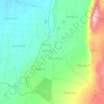
Name: Solai topographic map, elevation, terrain.

Location: Solai, Kabazi ward, Subukia, Nakuru, Kenya (-0.07826 36.10617 -0.03826 36.14617)

Average elevation: 1,753 m

Minimum elevation: 1,643 m

Maximum elevation: 1,995 m

Gear up for your next adventure:

🧥Packable Rain Jacket - Breathable waterproof layer for unpredictable weather
🧴Sunscreen SPF - Broad-spectrum sunscreen for outdoor activities
🔦UV Flashlight - Detect minerals or specific insects in the dark
🕶️Polarized Sunglasses - Protect your eyes with durable polarized lenses
🐕Hiking Dog Pack - Let your canine companion carry their own water and food

As an Amazon Associate, this site earns from qualifying purchases at no extra cost to you.