Geolocate

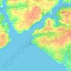
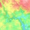
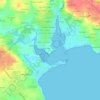
Crozon topographic map

Click on the map to display elevation.

About this map

Name: Crozon topographic map, elevation, terrain.

Location: Crozon, Châteaulin, Finistère, Brittany, Metropolitan France, 29160, France (48.16773 -4.57397 48.31124 -4.36227)

Average elevation: 19 m

Minimum elevation: -1 m

Maximum elevation: 127 m

Other topographic maps

Click on a map to view its topography, its elevation and its terrain.
Ar Vodennic

France > Brittany > Finistère > Plomodiern

Average elevation: 67 m

Garret

France > Brittany > Finistère > Menfig

Average elevation: 7 m

Pors Elenec

France > Brittany > Finistère > Roscoff

Average elevation: 7 m

Stêr an Ale

France > Brittany > Finistère > Plomodiern

Average elevation: 95 m

Espace du Kelenn

France > Brittany > Finistère > Carantec

Average elevation: 9 m

Park Mar

France > Brittany > Finistère > Scaër

Average elevation: 133 m

Kergonvel

France > Brittany > Finistère > Plouguerneau

Average elevation: 37 m

Kermoor

France > Brittany > Finistère > Port-la-Forêt

Average elevation: 20 m

Keraudry

France > Brittany > Finistère > Guipavas

Average elevation: 82 m

Gear up for your next adventure:

🧭GPS Tracker - Track your location in remote areas safely
🎒Fully Waterproof Backpack - Total protection for photography gear and electronics
🐕Hiking Dog Pack - Let your canine companion carry their own water and food
💡Portable Camping Lamp - Rechargeable lamp for campsite lighting
🥾Approach Boots - Comfortable boots for hiking and climbing approaches

As an Amazon Associate, this site earns from qualifying purchases at no extra cost to you.