
Marcas topographic map
Interactive map
Click on the map to display elevation.
About this map
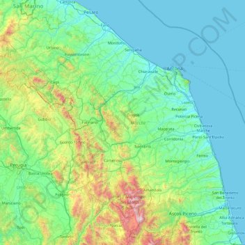
Name: Marcas topographic map, elevation, terrain.
Location: Marcas, Italia (42.68716 12.18545 43.97131 13.91635)
Average elevation: 337 m
Minimum elevation: -2 m
Maximum elevation: 2,445 m