
Lac Nichcotéa topographic map
Interactive map
Click on the map to display elevation.
About this map
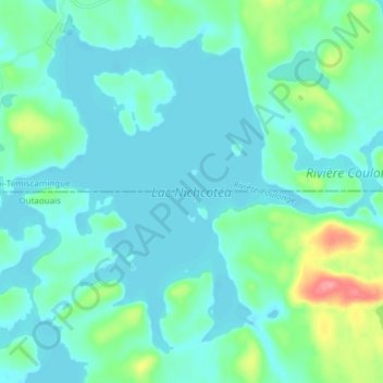
Name: Lac Nichcotéa topographic map, elevation, terrain.
Average elevation: 370 m
Minimum elevation: 353 m
Maximum elevation: 446 m
Other topographic maps
Click on a map to view its topography, its elevation and its terrain.
Lac Nouan
Canada > Québec > Réservoir-Dozois
Lac Nouan, Réservoir-Dozois, La Vallée-de-l'Or, Abitibi-Témiscamingue, Québec, Canada
Average elevation: 366 m
Lac Ash
Canada > Québec > Réservoir-Dozois
Lac Ash, Réservoir-Dozois, La Vallée-de-l'Or, Abitibi-Témiscamingue, Québec, Canada
Average elevation: 362 m