
Shoja topographic map
Interactive map
Click on the map to display elevation.
About this map
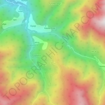
Name: Shoja topographic map, elevation, terrain.
Location: Shoja, Banjar, Kullu, Himachal Pradesh, India (31.54827 77.35098 31.58827 77.39098)
Average elevation: 2,486 m
Minimum elevation: 1,811 m
Maximum elevation: 3,265 m