
Isla Socorro topographic map
Interactive map
Click on the map to display elevation.
About this map
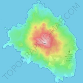
Name: Isla Socorro topographic map, elevation, terrain.
Location: Isla Socorro, Tecomán, Colima, Mexiko (18.71924 -111.05562 18.86625 -110.90765)
Average elevation: 149 m
Minimum elevation: 0 m
Maximum elevation: 1,036 m
Other topographic maps
Click on a map to view its topography, its elevation and its terrain.