Geolocate

Ar Vouster topographic map

Click on the map to display elevation.

About this map
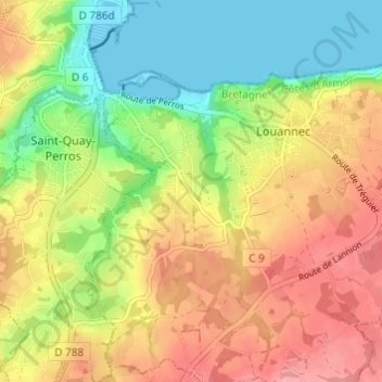
Name: Ar Vouster topographic map, elevation, terrain.

Location: Ar Vouster, Louannec, Lannion, Côtes-d'Armor, Bretagne, France métropolitaine, 22700, France (48.76773 -3.44670 48.80773 -3.40670)

Average elevation: 48 m

Minimum elevation: -2 m

Maximum elevation: 97 m

Other topographic maps

Click on a map to view its topography, its elevation and its terrain.

22700

France > Bretagne > Côtes-d'Armor > Louannec

Average elevation: 27 m

Gear up for your next adventure:

🪑Insulated Seat Pad - Protect your seat from cold rocks and wet logs
👟Trail Running Shoes - Agile footwear for fast-paced topographic exploration
🎒Backpack Rain Cover - External shield to keep your entire pack dry
🏕️Camping Hammock - Integrated protection for sleeping between trees
☕Camping Coffee Maker - Brew fresh coffee anywhere on the topographic map

As an Amazon Associate, this site earns from qualifying purchases at no extra cost to you.