Geolocate

El Queremal topographic map

Click on the map to display elevation.

About this map

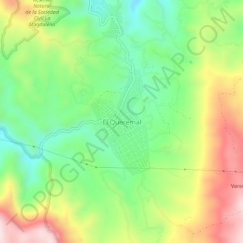
Name: El Queremal topographic map, elevation, terrain.

Location: El Queremal, Dagua, Sur, Valle del Cauca, RAP Pacífico, Colombia (3.50794 -76.73356 3.54794 -76.69356)

Average elevation: 1,545 m

Minimum elevation: 1,336 m

Maximum elevation: 1,845 m

Other topographic maps

Click on a map to view its topography, its elevation and its terrain.

Gear up for your next adventure:

🔋Emergency Crank Radio - Weather alerts and power without needing batteries
🕶️Polarized Sunglasses - Reduces glare from snow and water at high elevations
🧭GPS Outdoor Watch - Smart watch for navigation and fitness tracking in nature
🧢Outdoor Cap - Protective cap for sun and rain during hikes
🦶Anti-Blister Balm - Prevents friction and hotspots during long ascents

As an Amazon Associate, this site earns from qualifying purchases at no extra cost to you.