
Hopewell topographic map
Click on the map to display elevation.
About this map
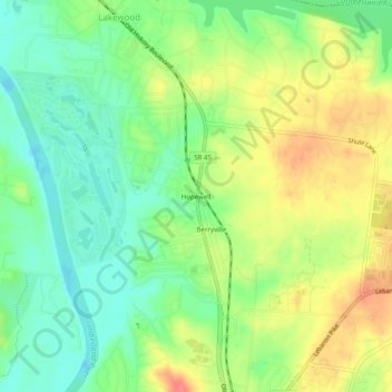
Name: Hopewell topographic map, elevation, terrain.
Average elevation: 145 m
Minimum elevation: 117 m
Maximum elevation: 182 m
Other topographic maps
Click on a map to view its topography, its elevation and its terrain.
Whites Creek
United States > Tennessee > Davidson County > Nashville-Davidson
Average elevation: 143 m