Geolocate

Coarsegold topographic map

Click on the map to display elevation.

About this map

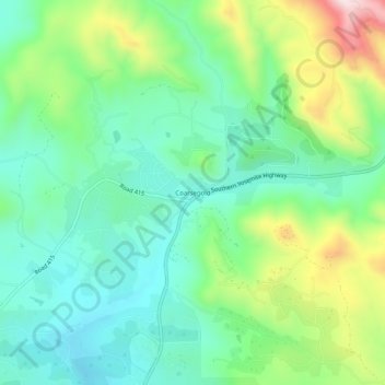
Name: Coarsegold topographic map, elevation, terrain.

Location: Coarsegold, Madera County, California, United States (37.24217 -119.72098 37.28217 -119.68098)

Average elevation: 764 m

Minimum elevation: 631 m

Maximum elevation: 1,067 m

Gear up for your next adventure:

👟Trail Running Shoes - Agile footwear for fast-paced topographic exploration
🧥Thermal Fleece Jacket - Versatile insulation for changing mountain temperatures
🌬️Windproof Camp Stove - Efficient cooking even on exposed mountain peaks
🔭Outdoor Binoculars - Lightweight binoculars for birdwatching and hiking
🧦Outdoor Socks - Durable socks designed for hiking and outdoor sports

As an Amazon Associate, this site earns from qualifying purchases at no extra cost to you.