

San Francisco topographic map
Click on the map to display elevation.
San Francisco
Because of its sharp topography and maritime influences, San Francisco exhibits a multitude of distinct microclimates. The high hills in the geographic center of the city are responsible for a 20% variance in annual rainfall between different parts of the city. They also protect neighborhoods directly to their east from the foggy and sometimes very cold and windy conditions experienced in the Sunset District; for those who live on the eastern side of the city, San Francisco is sunnier, with an average of 260 clear days, and only 105 cloudy days per year.
About this map
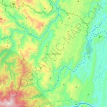
Name: San Francisco topographic map, elevation, terrain.
Location: San Francisco, Oriente, Antioquia, ???, Colombia (5.75110 -75.11752 5.99962 -74.84515)
Average elevation: 794 m
Minimum elevation: 258 m
Maximum elevation: 2,272 m