Geolocate

Indooroopilly topographic map

Click on the map to display elevation.

About this map

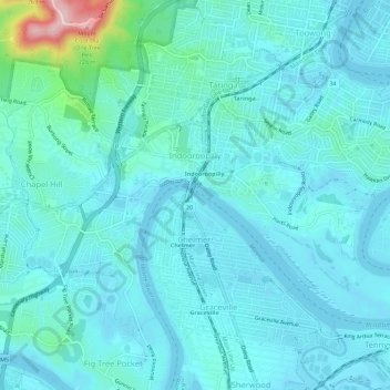
Name: Indooroopilly topographic map, elevation, terrain.

Location: Indooroopilly, Brisbane City, Queensland, 4068, Australia (-27.52317 152.95443 -27.49004 153.01076)

Average elevation: 26 m

Minimum elevation: 3 m

Maximum elevation: 226 m

Other topographic maps

Click on a map to view its topography, its elevation and its terrain.

Grange Heights

Australia > Queensland > Brisbane City

Average elevation: 34 m

Gear up for your next adventure:

🧦Outdoor Socks - Durable socks designed for hiking and outdoor sports
🗺️Topographic Maps - Detailed maps to explore trails, mountains, and wilderness areas
🥾Waterproof Hiking Boots - Essential footwear for rugged terrain and wet Canadian trails
🧥Insulated Jacket - Keep warm in cold outdoor conditions
🧰Survival Kit - Essential gear for emergencies in the wilderness

As an Amazon Associate, this site earns from qualifying purchases at no extra cost to you.