Geolocate

Cordovín topographic map

Click on the map to display elevation.

About this map

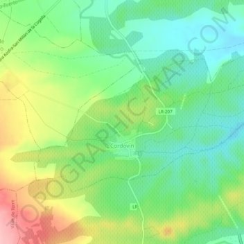
Name: Cordovín topographic map, elevation, terrain.

Location: Cordovín, La Rioja, España (42.37815 -2.83260 42.39827 -2.78497)

Average elevation: 605 m

Minimum elevation: 552 m

Maximum elevation: 695 m

Gear up for your next adventure:

💡Portable Camping Lamp - Rechargeable lamp for campsite lighting
🛶Canoe Life Vest - Safety vest for water sports
🦶Hiking Shoe Insoles - Added support for high arches and long days on feet
🥾Trail Hiking Shoes - Durable shoes designed for rugged trails
🥾Durable Hiking Shoes - Long-lasting shoes for frequent hiking

As an Amazon Associate, this site earns from qualifying purchases at no extra cost to you.