Geolocate

Tremp topographic map

Click on the map to display elevation.

About this map

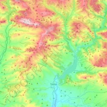
Name: Tremp topographic map, elevation, terrain.

Location: Tremp, Pallars Jussà, Lleida, Catalonia, 22583, Spain (42.10998 0.69530 42.37588 0.97176)

Average elevation: 908 m

Minimum elevation: 380 m

Maximum elevation: 1,876 m

Gear up for your next adventure:

🧦Outdoor Socks - Durable socks designed for hiking and outdoor sports
🥫Freeze-Dried Meals - Lightweight, high-calorie nutrition for multi-day treks
🪑Ultralight Camping Stool - Compact seating for rest stops during long hikes
🎒Hiking Daypack - Lightweight and durable backpacks for day trips and excursions
🛶Kayak Accessories - Essential gear for safe and fun kayaking adventures

As an Amazon Associate, this site earns from qualifying purchases at no extra cost to you.