Geolocate

Taltondi topographic map

Click on the map to display elevation.

About this map

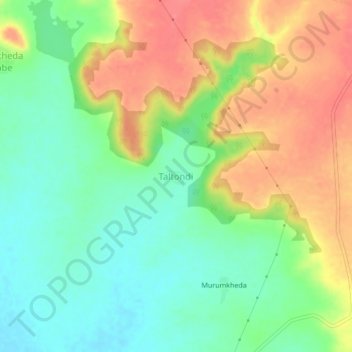
Name: Taltondi topographic map, elevation, terrain.

Location: Taltondi, Mantha, Jalna, Maharashtra, 431504, India (19.68690 76.37109 19.72690 76.41109)

Average elevation: 485 m

Minimum elevation: 454 m

Maximum elevation: 522 m

Other topographic maps

Click on a map to view its topography, its elevation and its terrain.

Mantha

India > Maharashtra > Mantha

Average elevation: 488 m

Gear up for your next adventure:

🧥Thermal Fleece Jacket - Versatile insulation for changing mountain temperatures
🥾Durable Hiking Shoes - Long-lasting shoes for frequent hiking
💡LED Headlamp - Hands-free illumination for night hiking and camping
🌬️Windproof Camp Stove - Efficient cooking even on exposed mountain peaks
🥾Trail Hiking Shoes - Durable shoes designed for rugged trails

As an Amazon Associate, this site earns from qualifying purchases at no extra cost to you.