
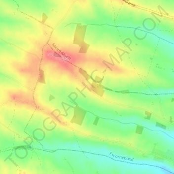
Le Tachon topographic map
Interactive map
Click on the map to display elevation.
About this map
Name: Le Tachon topographic map, elevation, terrain.
Average elevation: 194 m
Minimum elevation: 151 m
Maximum elevation: 239 m
Other topographic maps
Click on a map to view its topography, its elevation and its terrain.
Le Cazalas
France > Occitanie > Gers > Escornebœuf
Le Cazalas, Escornebœuf, Auch, Gers, Occitanie, France métropolitaine, 32200, France
Average elevation: 184 m
Bois de la Garnison
France > Occitanie > Gers > Escornebœuf
Bois de la Garnison, Escornebœuf, Auch, Gers, Occitanie, France métropolitaine, 32200, France
Average elevation: 182 m