
Make a donation
Gear up for your next adventure:
As an Amazon Associate, this site earns from qualifying purchases at no extra cost to you.
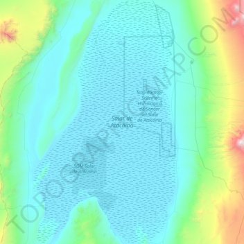
Salar de Atacama topographic map
Click on the map to display elevation.
Make a donation
Gear up for your next adventure:
As an Amazon Associate, this site earns from qualifying purchases at no extra cost to you.
Salar de Atacama
The salt flat encompasses 3,000 km2 (1,200 sq mi), is about 100 km (62 mi) long and 80 km (50 mi) wide, which makes it the third largest in the world, after Salar de Uyuni in Bolivia (10,582 km2 (4,086 sq mi)). and Salinas Grandes in Argentina (6,000 km2 (2,300 sq mi)). Its average elevation is about 2,300 m above sea level. The topography of the core portion of the salar exhibits a high level of roughness, the result of evaporation and ephemeral surface water, unlike the most other salt flats, as for example the Salar de Uyuni, which is periodically covered with shallow water.
Make a donation
Gear up for your next adventure:
As an Amazon Associate, this site earns from qualifying purchases at no extra cost to you.
About this map
Name: Salar de Atacama topographic map, elevation, terrain.
Location: Salar de Atacama, Antofagasta Region, Chile (-23.78629 -68.57340 -22.99316 -68.06436)
Average elevation: 2,632 m
Minimum elevation: 2,298 m
Maximum elevation: 5,268 m
Make a donation
Gear up for your next adventure:
As an Amazon Associate, this site earns from qualifying purchases at no extra cost to you.
Other topographic maps
Click on a map to view its topography, its elevation and its terrain.
Chiuchiu
Chile > Antofagasta Region > Provincia de El Loa > Calama
San Francisco de Chiu Chiu, or simply Chiu Chiu, is a village located about 30 km (19 mi) northeast of the city of Calama, in El Loa Province of Chile's northern Antofagasta Region. It lies at an elevation of 2,525 m (8,284 ft) above sea level, close to the confluence of the Loa and Salado rivers.
Average elevation: 2,543 m
Volcán Licancabur
Chile > Antofagasta Region > Provincia de El Loa > San Pedro de Atacama
The volcano is in the Puna de Atacama/Cordillera Occidental of the Andes. Politically, it is located in the Antofagasta Region of Chile and the Potosí Department of Bolivia; the border goes over Licancabur. Less than 20 kilometres (12 mi) south is the Llano del Chajnantor Observatory. San Pedro de Atacama is…
Average elevation: 5,285 m
Volcán Tátio
Chile > Antofagasta Region > Provincia de El Loa > San Pedro de Atacama
Average elevation: 4,850 m
Valle de la Luna
Chile > Antofagasta Region > Provincia de El Loa > San Pedro de Atacama
Average elevation: 2,531 m
Make a donation
Gear up for your next adventure:
As an Amazon Associate, this site earns from qualifying purchases at no extra cost to you.
Ojo de Agua
Chile > Antofagasta Region > Provincia de Antofagasta > Antofagasta
Average elevation: 19 m
Volcán Aucanquilcha
Chile > Antofagasta Region > Provincia de El Loa > Ollagüe
At Aucanquilcha volcano there is some fumarolic activity, and sulfur deposits are found at the summit. Several sulfur mines lie in the complex. One mine at an altitude of 5,950 metres (19,520 ft) was opened in 1913 and remained in use from 1950 to 1992. It was the world's highest mine during that period.…
Average elevation: 5,808 m
Atacama Large Millimeter/submillimeter Array
Chile > Antofagasta Region > Provincia de El Loa > San Pedro de Atacama > Atacama Large Millimeter/submillimeter Array
The Atacama Large Millimeter/submillimeter Array (ALMA) is an astronomical interferometer of 66 radio telescopes in the Atacama Desert of northern Chile, which observe electromagnetic radiation at millimeter and submillimeter wavelengths. The array has been constructed on the 5,000 m (16,000 ft) elevation…
Average elevation: 5,010 m